viZone
Functions & Modules
viZone for small projects
Focus on data storage & visualization
Overview
> Simple structure of your projects
> Unlimited data upload per project
> Unlimited number of users per project
> Data upload for point clouds, orthophotos and DXF plans
> Data storage manager with archiving
> IFC exchange
General
Key element “Data Structure Manager”
Intelligently structuring data plays a huge role in large-scale construction sites, as data is collected daily from data is collected and stored from different filed by different areas.
These need to be further used centrally in one place: mostly in the office. With the viZone you can significantly improve and simplify your workfl ows. Even for small projects.
The key functions
> Centralized data storage
> Control access in a managed way
> Work together with data
> Same data basis for all
> Data storage via archive memory
> Work in point clouds in the data viewer
> Storing and displaying CAD data
viZone for small projects
Organize project into simple structures
viZone for small projects
Quantity determination
viZone for large construction sites
Preliminary stage to remote supervision
Overview
> unlimited data upload for your company
> additional data and formats
> data processing SfM
> automated for data sets up to 10.000 images or point clouds up to 40GB
> individual workflow programming for standard processes in your company or your project
General
Our intelligent archive storage is designed to archive data that is not directly needed are archived. However, the data is available again in a few seconds at any time. Import also other basic data, such as IFC and BCF or DXF and XML data directly into the viewer. Or simply dock your hardware directly. You are welcome to ask which hardware already supports viZone. Often implementations are also possible within the configuration.
Key element “Data Viewer”
With viPoint, in addition to simple point cloud tools such as trimming or thinning point clouds, complex functions such as object classifications can be applied.
Digitization and modeling tools are available in viPlan: to be able to generate settlement areas or as-built plan data automatically.
The key functions
> store large amounts of data
> control accesses in a guided manner for each project
> image data processing PIX4Dengine with new matic pipeline available
> direct processing of point clouds without software via viPoint
> AI tools to support digitizing tasks via viPlan module
> work in point clouds in data viewer PRO
> IFC import and comparison data creation to point clouds
> create, import, edit and share tasks with other project participants
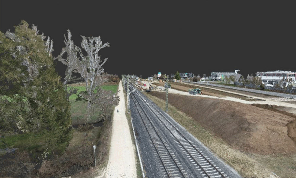
viZone for large construction sites
Area Processing - viZone
viZone data viewer
Visualize data and work with results
Overview
> point clouds
> orthophotos
> CAD data
> GIS data
> IFC models
> viewpoints
> tasks
Basic functions
The viewer also shows you directly the results from SaaS solutions, such as viPoint.
You do not need any additional authoring software to prepare the data. After preparation, you can import the data in various formats into your authoring software to continue with subsequent steps.
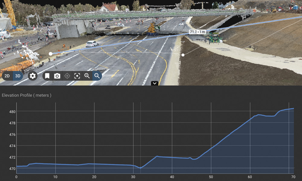
Key element “Sort Function”
The key functions
> visualize data
> measurement functions
> inspection and documentation functions
> digitize/vectorize
> profiling
> compare data
viZone data viewer
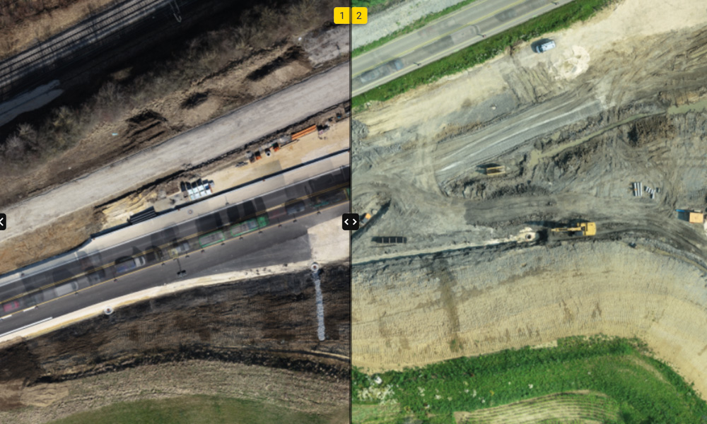
Directly compare states in 2D/3D compare with each other
viZone data viewer
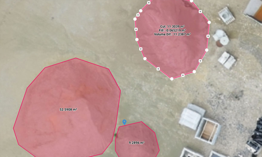
Create control cuts and compare
viZone data processing
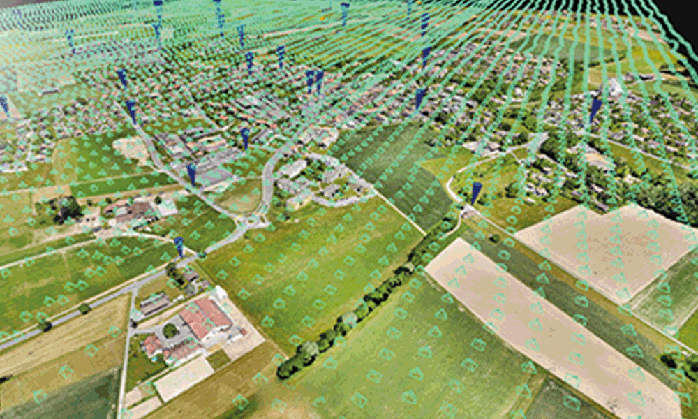
Photogrammetric cloud processing for your drone projects and more
Overview
> best quality and speed
> automatic target detection
> filter moving objects
> define different processing areas
> performance optimization for viDoc & LIDAR Processing
> quality reporting
Basic functions of the processing engine
The engine is designed to allow customization, automation and integration for all project types: to capture reality in photogrammetry.
The processing engine, as well as the entire Platform, are hosted on AWS in secured server centers.Data security, even for critical infrastructure, is controlled by our authorization system based on person and location.
Workaround
Create accurate, georeferenced orthomosaics, triangle meshes, point clouds and elevation models.
PIX4D‘s processing algorithms ensure you get the precise survey results you need. The auto-GCP function offers an automated verification of your generated models.
Discrepancies can be resolved more quickly because you are always aware of the current project status and everything is documented.
The key functions
> high-end processing service from the market leader
> variable outputs
> direct interface for further processing of the results
> automated processes
> payment according to consumption
> infinitely scalable
> verifiable quality
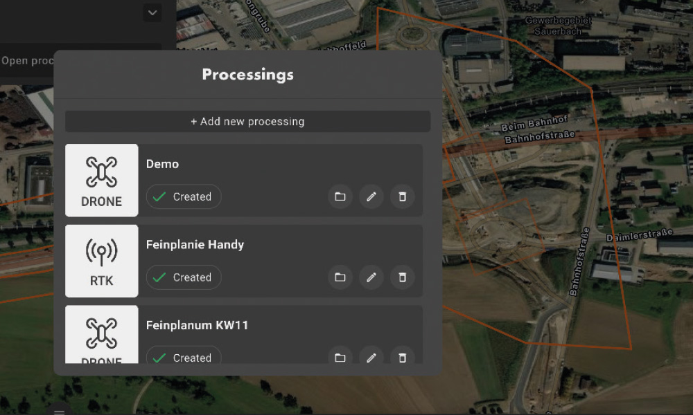
viZone data processing
Task-related data collection and validation. Centrally controlled via tasks.
viZone module viPoint®
Target-oriented processing of point clouds
Overview
> different point clouds
> extensive functions
> view results directly
> targeted processing according to use case
> optimized for large data volumes
Basic functions
Whether thinning, cropping or classifying: the list of possibilities in viPoint is versatile. Your results can be viewed directly. You do not need any local computing power.
Individually adaptable
For construction sites, basic filters and classifiers are available, which e.g. exclude construction machines or materials out. In preparation for the derivation of terrain models, the vegetation can also be extracted.
The key functions
> thinning, filtering, trimming
> classification according to LAS standard
> transformations
> noise filter terrain, background filter
> road noise filter
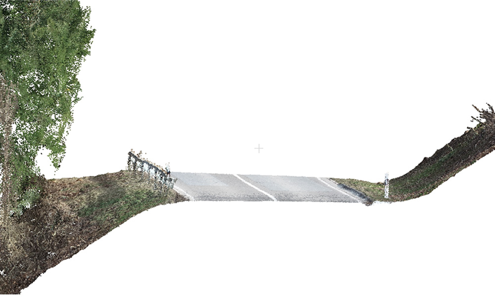
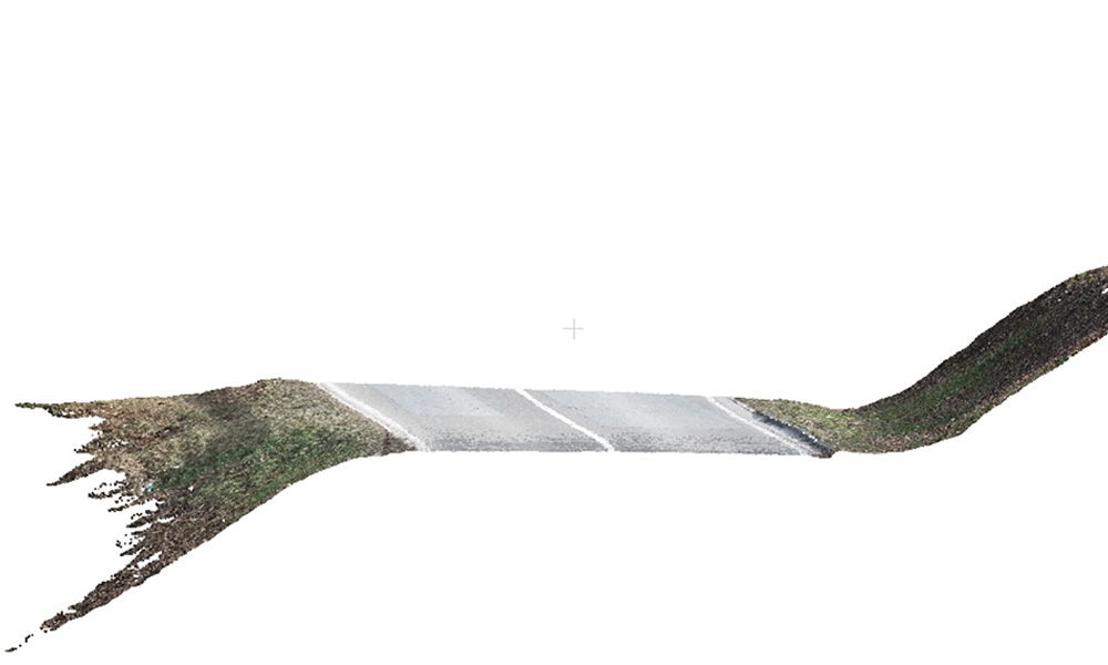
viZone module viPoint®
Noise filter
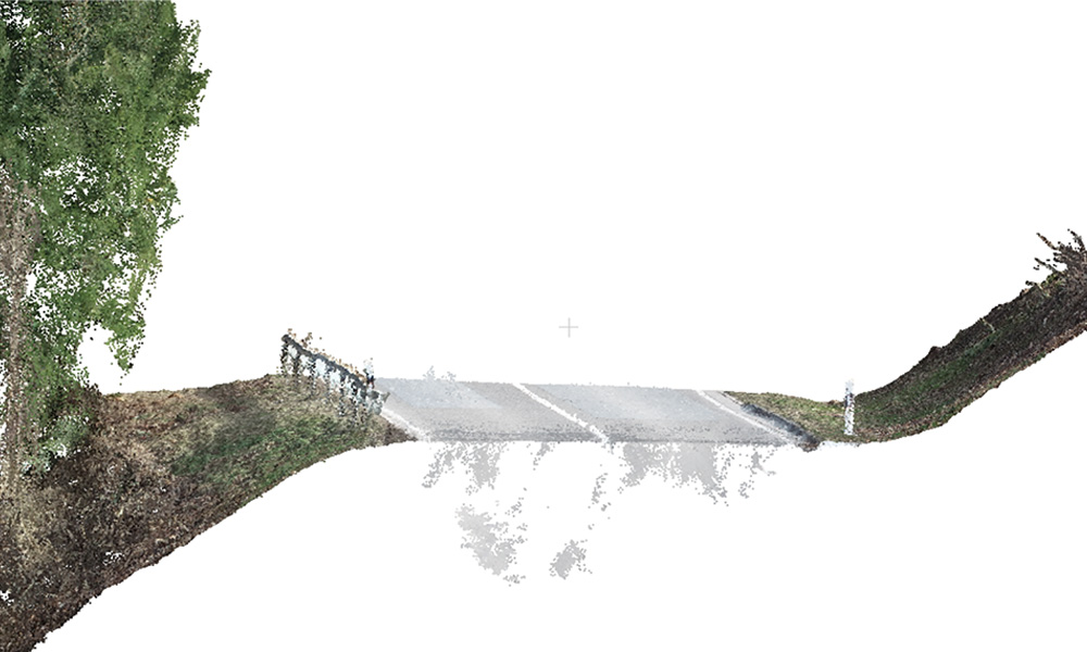
viZone module viPoint®
Raw model
viZone module viPoint®
Soil classification
viZone module viPoint®
Classifying a point cloud: raw data and with viPoint® optimized: in between there is only one click!
“Point clouds and their processing tie up a lot of resources. With the viZone we simplify and automate these processes. The result is a faster usability of these data and large data volumes: from different systems – united in one project.”
Dr.-Ing. Fatemeh Alidoost
Head of point cloud AI team

viZone module viPlan
For the automatic derivation of 2D/3D state data
Overview
> image-based AI
> intelligent pointcloud algorithms
> LIS cooperation
> standard output formats
Basic functions
viPlan is supported by image-based object recognition and pointcloud-specific algorithms for the automatic derivation of 2D/3D condition data.
Especially in the area of condition assessment before the start of a measure and during completion, the viPlan module brings considerable savings potential.
Key element “AI based object recognition”
This information forms the basis for the profile-like 3D modeling of the route inventory. The module already supports this type of work to a high percentage, depending on the requirements.
However, quality assurance should always be performed by an expert engineer.
The key functions
> object detection
> damage detection
> 3D vectorization
> 3D reconstruction
> terrain models
> fracture edge detection
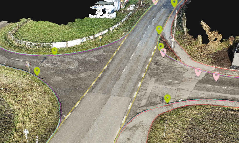
viZone module viPlan
Derivation of inventory plan data
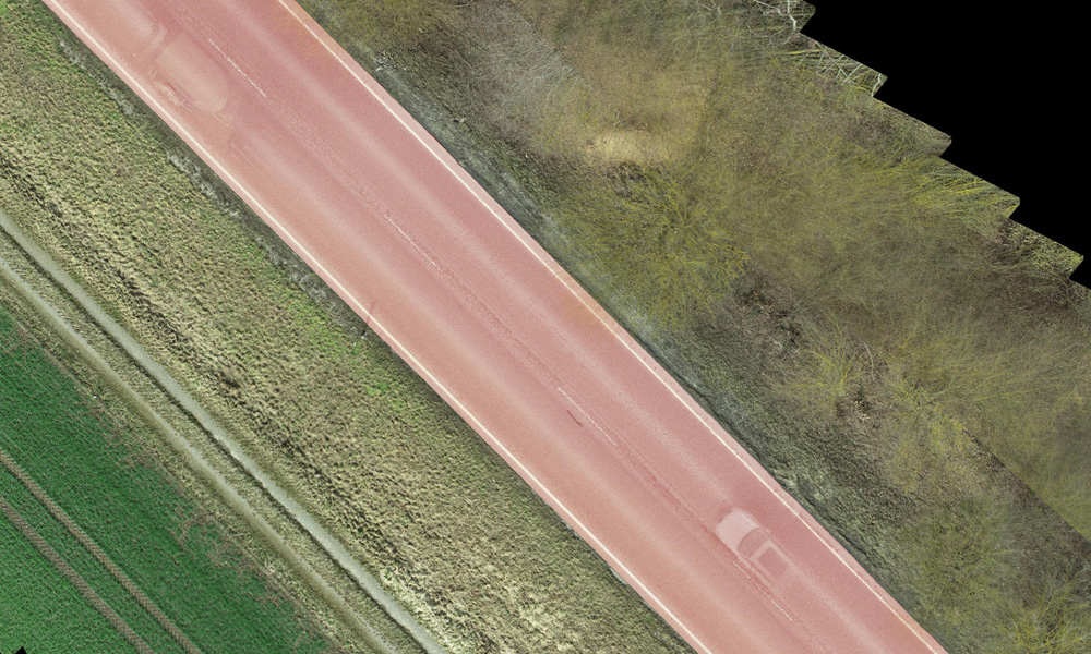
viZone module viPlan
Object detection roadway
viZone module viPlan
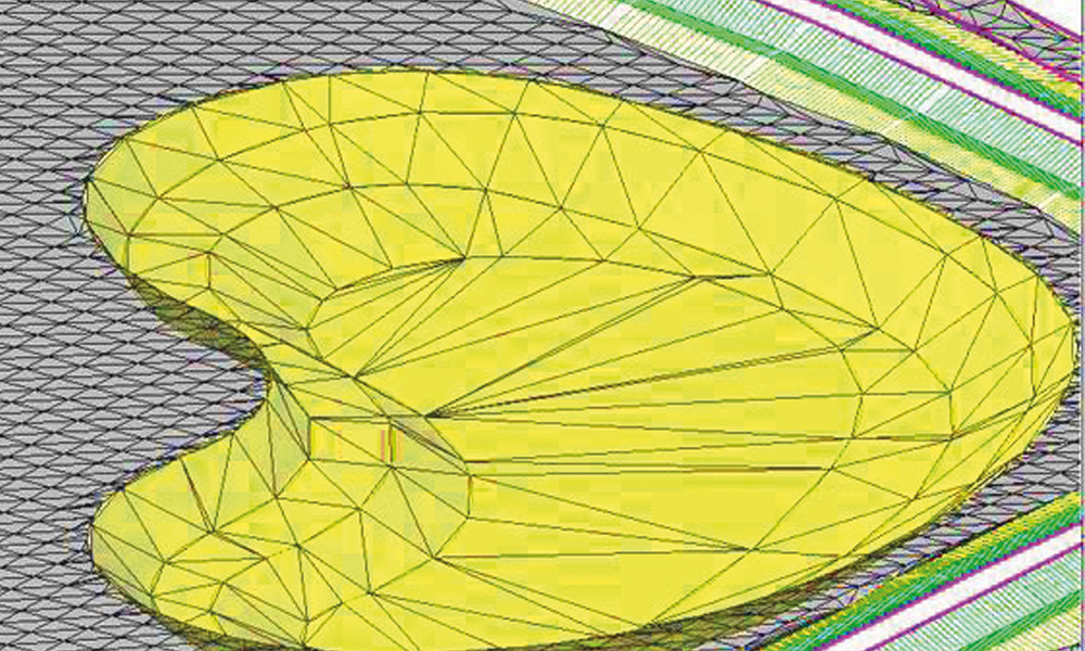
3D terrain mesh